
Mapping with Drones 02 Field Day
COURSE
Course description
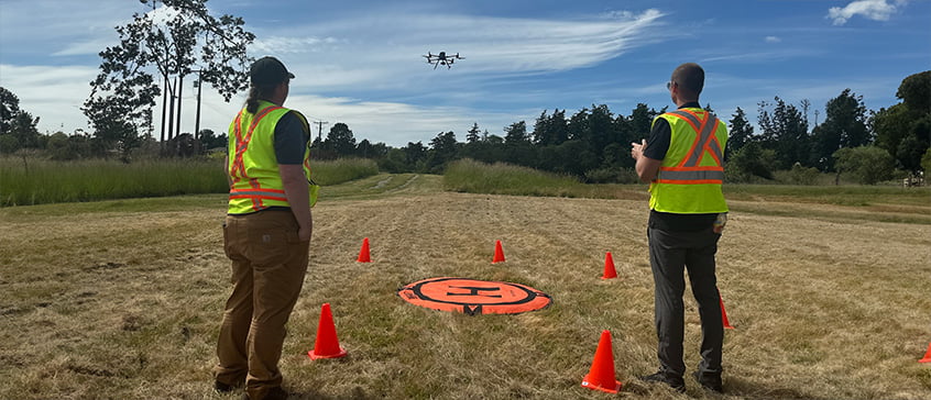
Elevate your Mapping with Drones experience and join us for an in-person field session.
If you have completed Mapping with Drones 2, this is your opportunity to gain hands on experience with ground control survey using RTK GNSS.
You will learn and practice mobilizing, configuring and acquiring data using base and rover RTK GNSS equipment to calibrate and validate a drone mapping survey.
Prerequisites
In order to participate in the field experience activity you must have completed MWD02 and must provide informed consent.
Registration details
Select your offering:
You have already registered for this course.
This item is already in your shop cart.
You're already on the waiting list for this item.
Sorry, this section is full.
Online registration temporarily unavailable
Sorry, this course is not available for registration at this time.
This course is in progress. Please contact us for more details.
Online registration is closed for this course. You may still be able to register by phone. Call 250-472-4747 to find out.
This course is on your wish list. You will be notified when this course becomes available.
Want to receive notification when this course becomes available?
{{ loggedIn ? 'Add to wish list' : 'Sign in/create a new account to add to wish list' }}Info you should know: